|
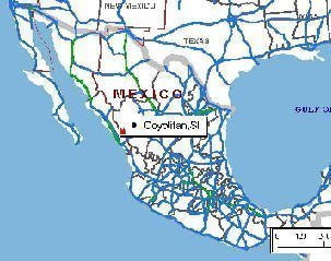
Coyotitan, Sinaloa, Mexico.

| |
|
 |
 |
|
|
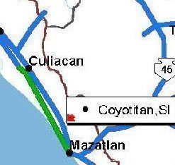
| Coyotitan is located: between
Culiacan (140 km) and Mazatlan (70 km) and about 40 km from the seashore |
| |

Getting to PROJIMO- Coyotitan
|
|
From the airport of MAZATLAN: |
|
|
If you make advance arrangements with PROJIMO, someone can
pick you up at the Mazatlan airport. (US$35.00/ trip)
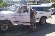
PROJIMO's F150 pickup truck
will "pick you up and drop you off!" |
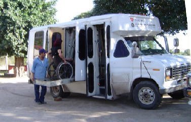
PROJIMO's wheelchair-accessible bus.
|
There is no direct bus line from the airport to the project.
I have been told that the connection is rather complicated.
The bus from the airport to Mazatlan stops at a different terminal than
the bus from Mazatlan towards San Ignacio, and those 2 terminals are more
than a comfortable walking distance from each other.
If you want to arrive at the project by bus, on your own, you'll best take
a taxi from the airport to the bus station for the bus to San Ignacio.
That will probably cost you more than what PROJIMO charges to pick
you up at the airport.
Coyotitan is the first village immediately after the bus turns off the
"Libre."
Do not stay on the bus until you are in San Ignacio! PROJIMO is
just "on the other side" outside of the village-proper of Coyotitan.
There is a bus stop at the Big Tree in Coyotitan. Past that you'll see a
soccer field on the right, and a COBAES (high school) on the left. PROJIMO
is on the left, immediately past those two. There are 2 very visible
signs.
If you tell the driver that you need to be at Proyecto PROJIMO, he will
drop you off right in front of the project.

If you prefer to rent a car at the airport:
Outside the airport, follow the signs through Mazatlan going North towards
Culiacan.
At the North side of Mazatlan, choose either the "Libre" or the
"Cuota" (Toll road = + 110 pesos)

|
|
By car: |
Autopista
Mazatlan-Culiacan: (= toll road)
= 4 lane road with separated opposing lanes.
 | Exit near km 62 at the overpass of Estacion Dimas. Be careful
not to miss it. It is not a very noticeable exit.
|
 | Go East towards the mountains about 20 miles to the "Libre". |
 | Take a right towards Mazatlan and follow for about 1 mile. Near km67
take left turn at the sign for San Ignacio.
|
 | Taking the Autopista from Mazatlan not only is a significant detour,
but it will also cost you.
From Culiacan, timewise about the same , but in my opinion safer.
|
|
Libre Mazatlan-Culiacan:
1 hour from Mazatlan, 2 hours from Culiacan.
 | Near km 67 turn East towards the mountains at the sign for San
Ignacio. |
 | Follow the road into and through Coyotitan, until you see the PROJIMO
sign. |
|
WARNING:
 |
The Libre is a 2-lane road without shoulder lane. |
 |
There is almost always a lot of heavy truck traffic. |
 |
If you get stuck behind a truck, BE PATIENT, or else... |
|
 |

|
|
 |
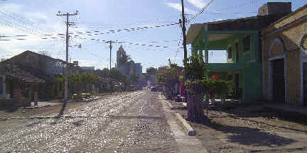 |
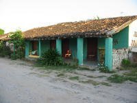
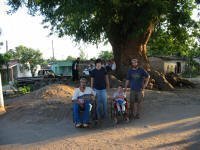
| Coyotitan is one of the nicer villages. Most of
its streets are paved, with the houses fairly well kept. Overall, it is a
peaceful, and relatively safe village where a foreign visitor can walk
around alone without having to fear for life and goods. UPDATE 2011:
In August 2011, 5 youngsters (16-18 years old) were killed in a drive-by
shooting at the food stand under the Gran Arbol.
|
|
|

Coming into town from the "Libre": El Grand Arbol.
The Big Tree.
|
|
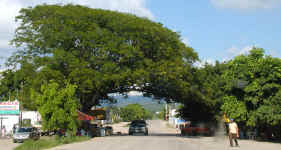

PROJIMO is about 500 m further down this road.


|
|
|
|
|
|
|
|

|
|
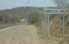
25km North of Mazatlan: Tropic of Cancer (June = dry season)
|
| Two of the many eye-catching plants in the area |


|

Page last modified:
October 27, 2011
Return to
PROJIMO home page
Return to my homepage:
www.avemariasongs.org

|
![]()